

Iceland's South Coast: A Detailed Self-Drive Guide
This post may contain affiliate links. If you make a purchase through one of these links, I may earn a small commission at no additional cost to you.
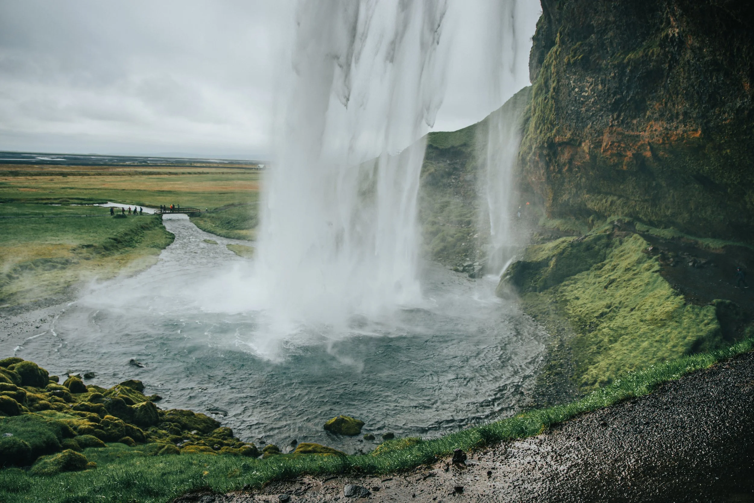
If you only have time to explore one part of Iceland outside Reykjavík, the South Coast is one of the easiest places to recommend.
This stretch of Iceland has a little bit of everything the country is known for. Enormous waterfalls fall from cliffs beside the Ring Road, glaciers spill down between mountains, black sand beaches stretch along the Atlantic, and moss-covered lava fields make parts of the drive look like another planet.
It is also surprisingly easy to explore by car. Many of the major attractions are located directly along Route 1 or only require a short detour, which makes the South Coast especially good for travelers trying to see a lot of Iceland without using a huge amount of PTO.
Iceland is one of my favorite places in the world, and the South Coast is a big reason why. I have driven portions of this route more than once, and somehow the scenery still makes me want to stop every five minutes to take another photograph.
This guide covers everything from Seljalandsfoss and Skógafoss to Reynisfjara, Vík, and Fjaðrárgljúfur, plus a few places that are easy to miss. If you have additional time, I have also included directions for continuing farther east toward Skaftafell, Jökulsárlón Glacier Lagoon, and Diamond Beach.
If you're combining the South Coast with the Golden Circle, my 3-day Iceland itinerary shows how I would organize both regions into one realistic short trip.
If you're planning the Golden Circle separately, my Golden Circle self-drive guide covers the route, stops, driving times, and how long I'd actually allow at each one.
At a Glance
The biggest mistake you can make on the South Coast is looking at the driving time on Google Maps and assuming that is how long the day will take.
Technically, you can drive from Reykjavík to Vík in roughly 2.5 hours without stopping. You are absolutely not going to do that.
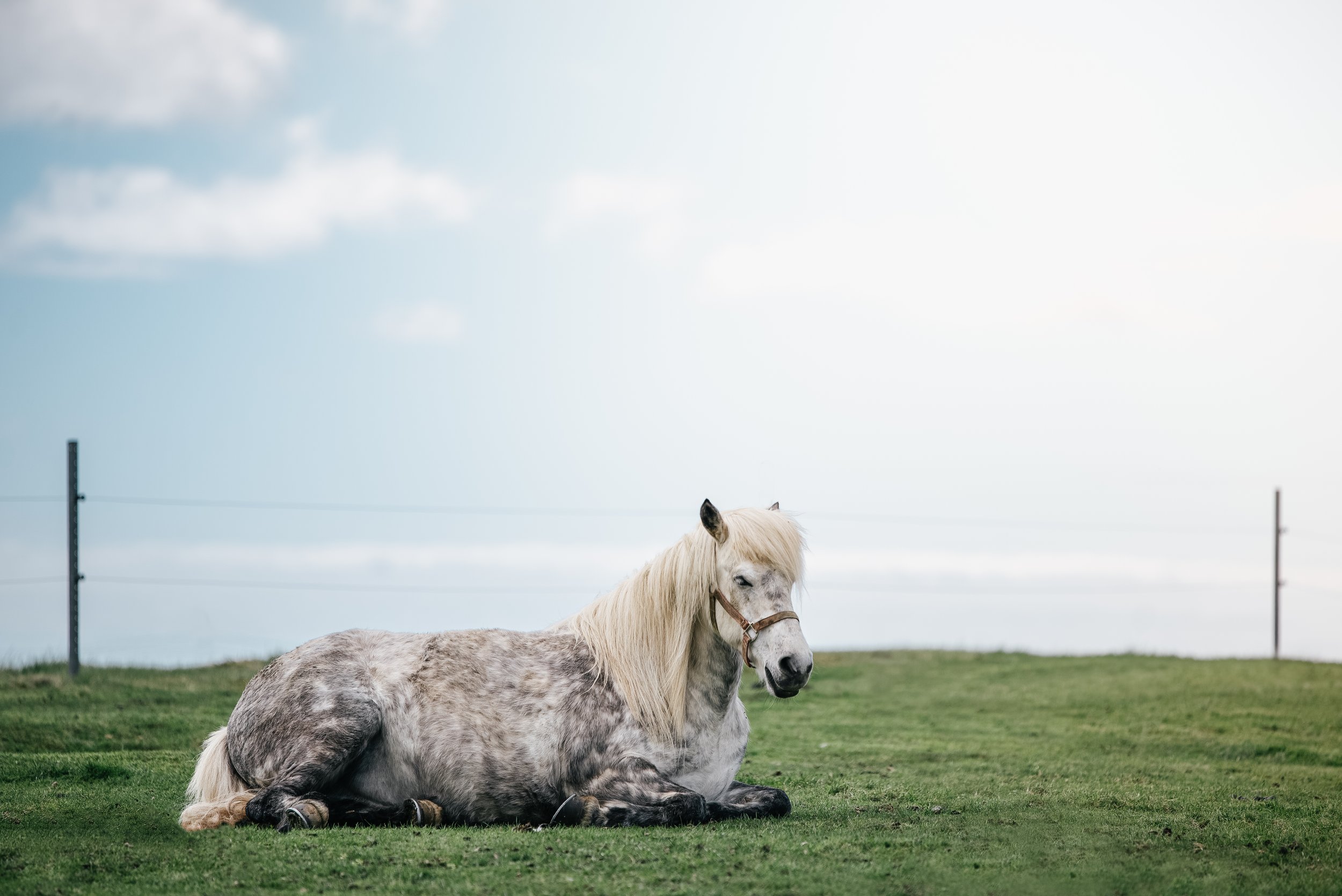
There are waterfalls beside the road. There are mountains. There are horses. There will probably be sheep. You will see some random landscape and suddenly decide you need to pull over and photograph it. Then you'll spend longer than expected at a waterfall because it is much more impressive in person.
I have learned this lesson personally.
I once found myself much farther east than I probably should have been while realizing I eventually needed to make my way back toward the airport. It worked out, but racing across Iceland because you underestimated how long sightseeing would take is not the part of the trip I recommend recreating.
How Much Time Do You Need for Iceland's South Coast?
You can see the major South Coast attractions as a very long day trip from Reykjavík, but I think two days is significantly better.
With one day, I would concentrate on Seljalandsfoss, Skógafoss, Dyrhólaey, Reynisfjara, and Vík. Depending on how early you leave and how much daylight you have, you could also add Kvernufoss or Sólheimajökull.
With two days, you have enough time to slow down, spend the night around Vík, add places like Sólheimajökull and Fjaðrárgljúfur, and avoid spending the entire trip checking the clock.
If you have three or more days for the South Coast, continue east toward Skaftafell and Jökulsárlón. Jökulsárlón alone is roughly five hours from Reykjavík without sightseeing stops, so I would not try to squeeze it into a normal South Coast day trip from the capital.
This is one of those places where an extra day makes a huge difference.
When Is the Best Time to Visit Iceland's South Coast?
You can visit the South Coast year-round, and the experience changes considerably with the seasons. The main South Coast route is accessible year-round, but Iceland's weather and road conditions can change quickly.
For a first road trip, I think late spring through early fall is the easiest time to visit. You'll have considerably more daylight, generally easier driving conditions, and better access to walking paths that can become icy or closed during winter.
Summer also gives you an almost ridiculous amount of daylight. This is extremely helpful when you work a full-time job and are trying to squeeze Iceland into a short trip because you can keep exploring much later than you normally could.
Winter is completely different but equally beautiful. Waterfalls can be surrounded by ice, mountains are covered in snow, and longer nights give you the possibility of seeing the Northern Lights. The tradeoff is shorter daylight, more unpredictable driving conditions, and the possibility that roads or walking paths will temporarily close.
No matter when you visit, I would keep your itinerary somewhat flexible. Check the weather, road conditions, and SafeTravel before heading out each morning. Iceland is not the place to decide that your itinerary must continue exactly as planned, regardless of the weather. SafeTravel specifically warns that conditions can change quickly and recommends monitoring current travel conditions.
If you're planning the Golden Circle separately, my detailed Golden Circle self-drive guide covers the route, stops, driving times, and how long I'd actually allow at each one.
Do You Need a 4WD for the South Coast?
For the major stops in this guide, you generally do not need a 4WD in good road conditions.
Route 1 is Iceland's main highway, and the major South Coast attractions are primarily reached from it or from relatively short connecting roads. A normal rental car is usually enough during the warmer months.
Winter is different. Snow, ice, wind, and changing road conditions can make a vehicle that was perfectly adequate in July feel very different in January. Choose your rental car based on the season rather than assuming a single vehicle type works for every trip to Iceland.
And do not drive onto an F-road simply because Google Maps suggests it. Highland roads have different vehicle requirements and seasonal access restrictions.
South Coast Stops at a Glance
| Stop | Time I’d Allow | My Take |
|---|---|---|
| LAVA Centre | 1 to 1.5 hours | Optional, but surprisingly good |
| Seljalandsfoss + Gljúfrabúi | 1 to 1.5 hours | Absolutely stop |
| Skógafoss | 45 to 60 minutes | Must-see |
| Kvernufoss | 45 to 60 minutes | Add if you have time |
| Sólheimajökull | 45 to 90 minutes | Great glacier stop |
| Sólheimasandur Plane Wreck | 2+ hours walking | Only if it genuinely interests you |
| Dyrhólaey | 30 to 60 minutes | Fantastic coastline views |
| Reynisfjara | 30 to 60 minutes | Must-see, but take the ocean seriously |
| Vík | 30 minutes to several hours | Good overnight base |
| Eldhraun | 15 to 30 minutes | Easy scenic stop |
| Fjaðrárgljúfur | 1 to 1.5 hours | Worth continuing east |
| Skaftafell | Several hours | Best with an extra day |
| Jökulsárlón + Diamond Beach | 1.5 to 3 hours | Worth the drive if your itinerary allows |
The times above are intentionally flexible. I photograph everything, so apparently I am incapable of spending only ten minutes at a waterfall.
LAVA Centre
I know. You came to Iceland to see waterfalls, glaciers, and landscapes, and I am immediately telling you to go inside a museum. Hear me out.
The LAVA Centre in Hvolsvöllur is an interactive exhibition about Iceland's volcanoes, earthquakes, eruptions, and geology. It gives you a much better understanding of why the country you're about to drive through looks the way it does. I really enjoyed it.
Iceland is one of those places where the geology is not just something sitting in the background. You are constantly driving beside glaciers, across old lava flows, underneath volcanoes, and through landscapes that are actively changing. Understanding even a little of what created them makes the rest of the drive more interesting.
I would consider the LAVA Centre optional on a very short trip, simply because there is so much to see outdoors. However, it is a great stop if the weather is bad, you're interested in Iceland's geology, or you have enough time to explore without rushing.
Check its current opening hours before visiting, rather than planning around a fixed schedule.
Seljalandsfoss and Gljúfrabúi
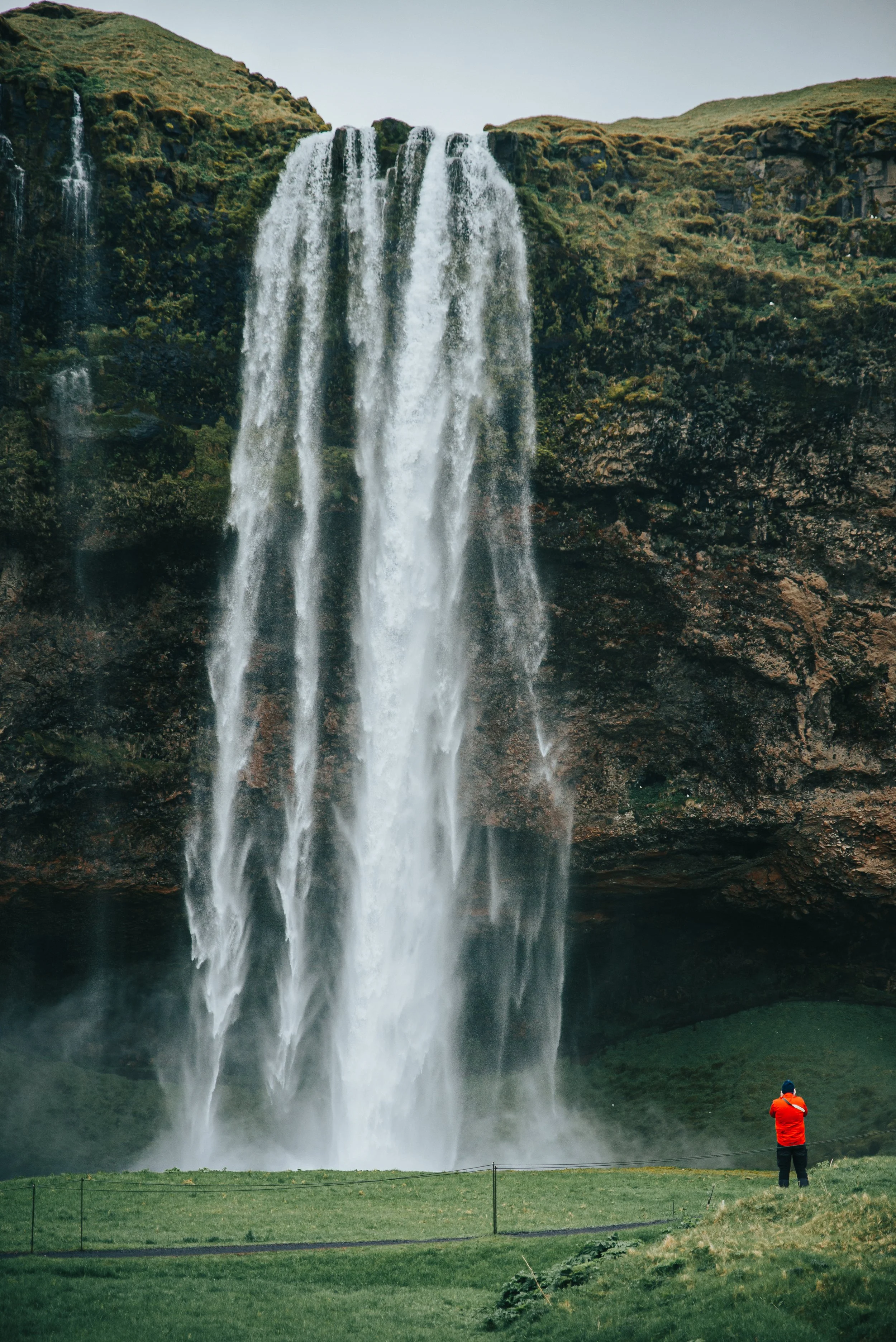
This is where the South Coast really starts to feel like the Iceland you imagined before arriving. Seljalandsfoss drops roughly 60 meters (about 200 feet) from the cliffs and is famous for the walking path that curves behind the waterfall. On a nice day, walking behind it gives you one of the coolest perspectives of any waterfall in Iceland.
You are also going to get wet. Bring a waterproof jacket, protect your camera, and expect the path to be slippery. During colder months, the path behind Seljalandsfoss can close because the spray freezes around the cliffs and trail. If it is closed, respect the closure. You can still get a beautiful view from the front.
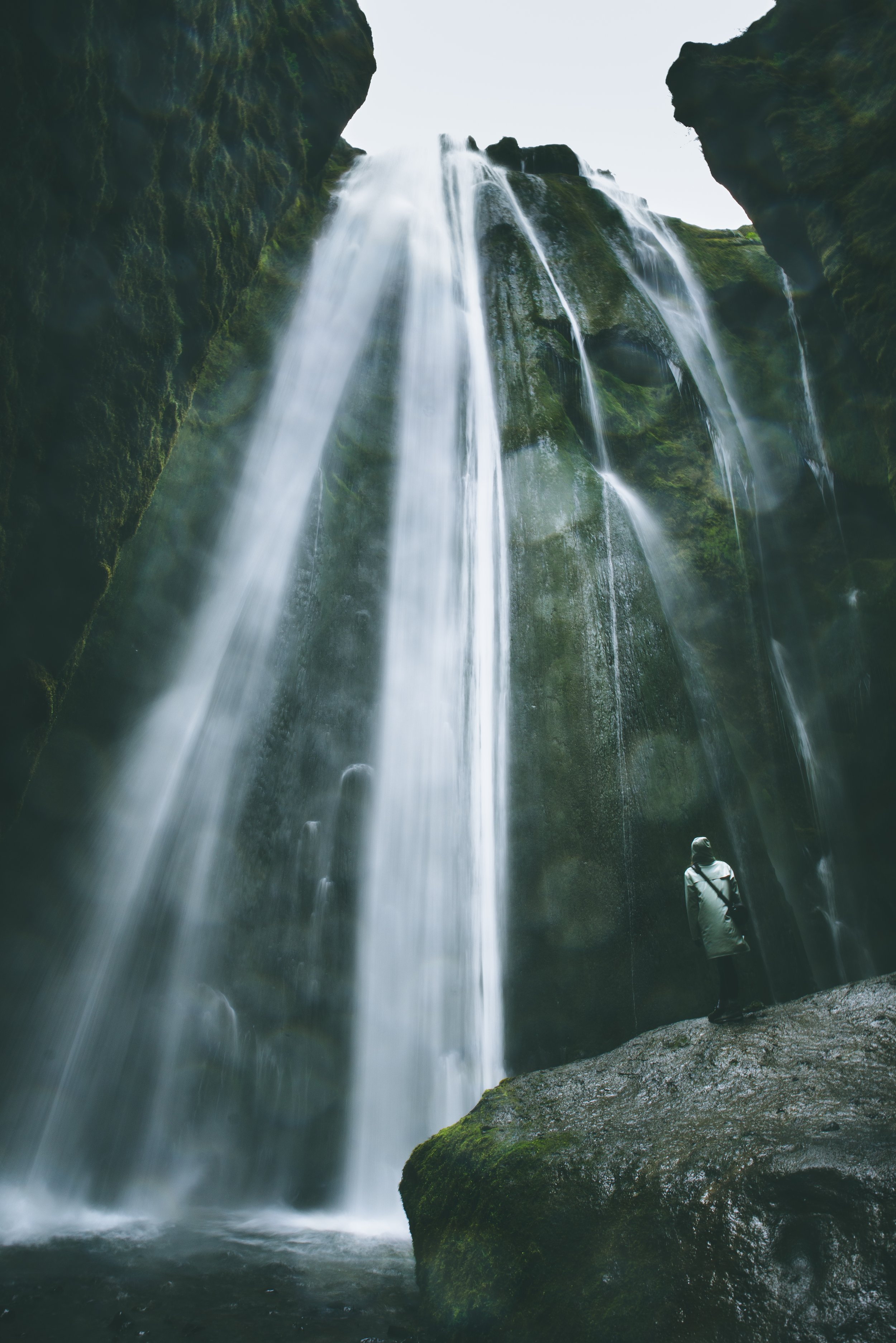
But do not leave after Seljalandsfoss. Continue walking along the path toward Gljúfrabúi, a smaller waterfall hidden inside a narrow gorge only a short walk away. Gljúfrabúi is still one of my favorite waterfalls in Iceland.
From the outside, you can barely see it. To really experience the waterfall, you have to make your way into the opening in the rock and follow the shallow stream into the gorge. Once you're inside, the canyon opens up, and the waterfall drops directly in front of you.
This is another place where waterproof shoes and clothing are extremely helpful. You may be stepping across wet rocks, the waterfall produces plenty of spray, and staying completely dry is not really the point. Official South Iceland information describes Gljúfrabúi as a 40-meter waterfall hidden inside the gorge and recommends allowing extra time when visiting it with Seljalandsfoss.
What I'd recommend: Do both. Seljalandsfoss gets most of the attention, but I would not visit one without walking over to the other.
Skógafoss
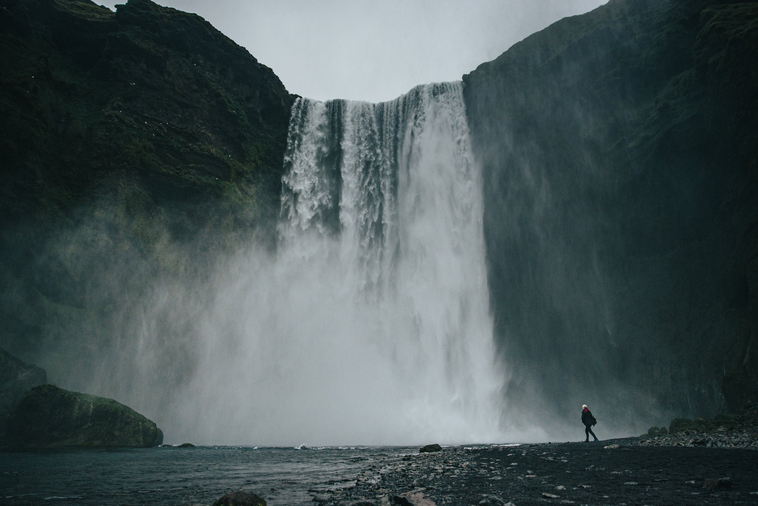
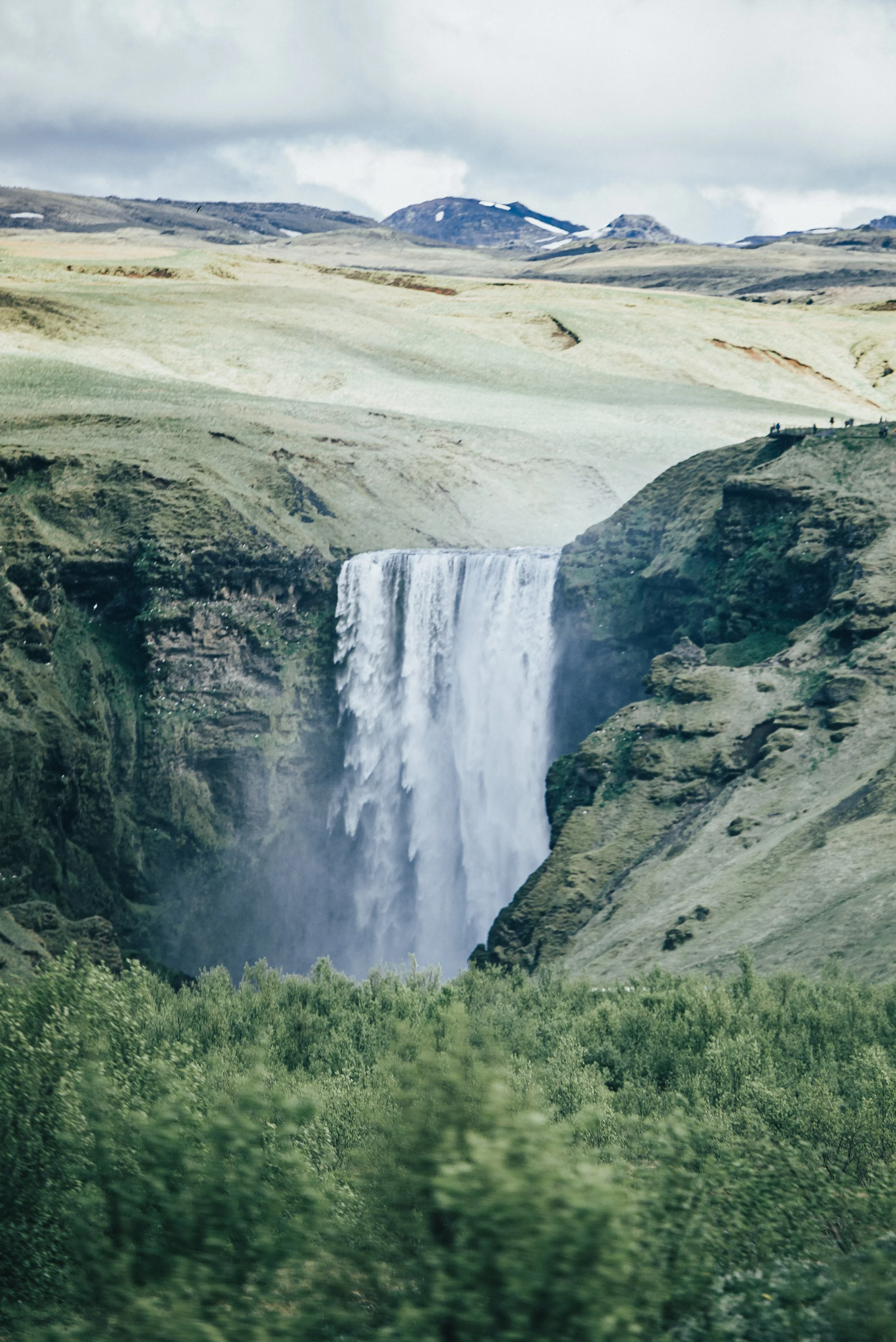
Skógafoss is one of those places that somehow still feels enormous even when you have already seen hundreds of photographs of it. The waterfall is approximately 60 meters tall and 25 meters wide, with an enormous amount of water crashing onto the rocks below. You can walk across the flat ground almost directly toward the base, which is the best way to appreciate how powerful it actually is.
You will probably get wet here, too. On sunny days, all of that mist also means you have a good chance of seeing a rainbow in front of the falls.
If you're still learning how to photograph waterfalls, landscapes, or changing light while traveling, my Photography Basics guide covers the camera settings and techniques I actually use.
To the right of Skógafoss is a long staircase leading to a viewing platform above the waterfall. There are more than 400 steps, so this is not exactly a casual stroll after getting out of your car, but the view from the top gives you a completely different perspective over the waterfall and the surrounding South Coast.
If you're short on time, seeing Skógafoss from below is enough. If you have the energy and another 20 to 30 minutes, I think the climb is worth doing.
And yes, this is another place where I always seem to see sheep.
Kvernufoss
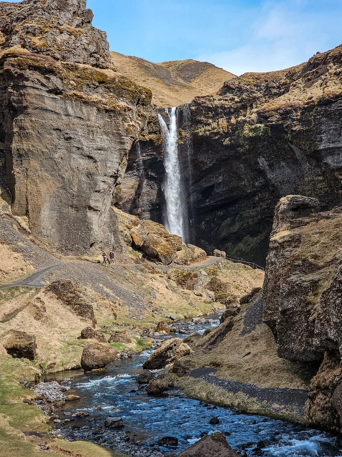
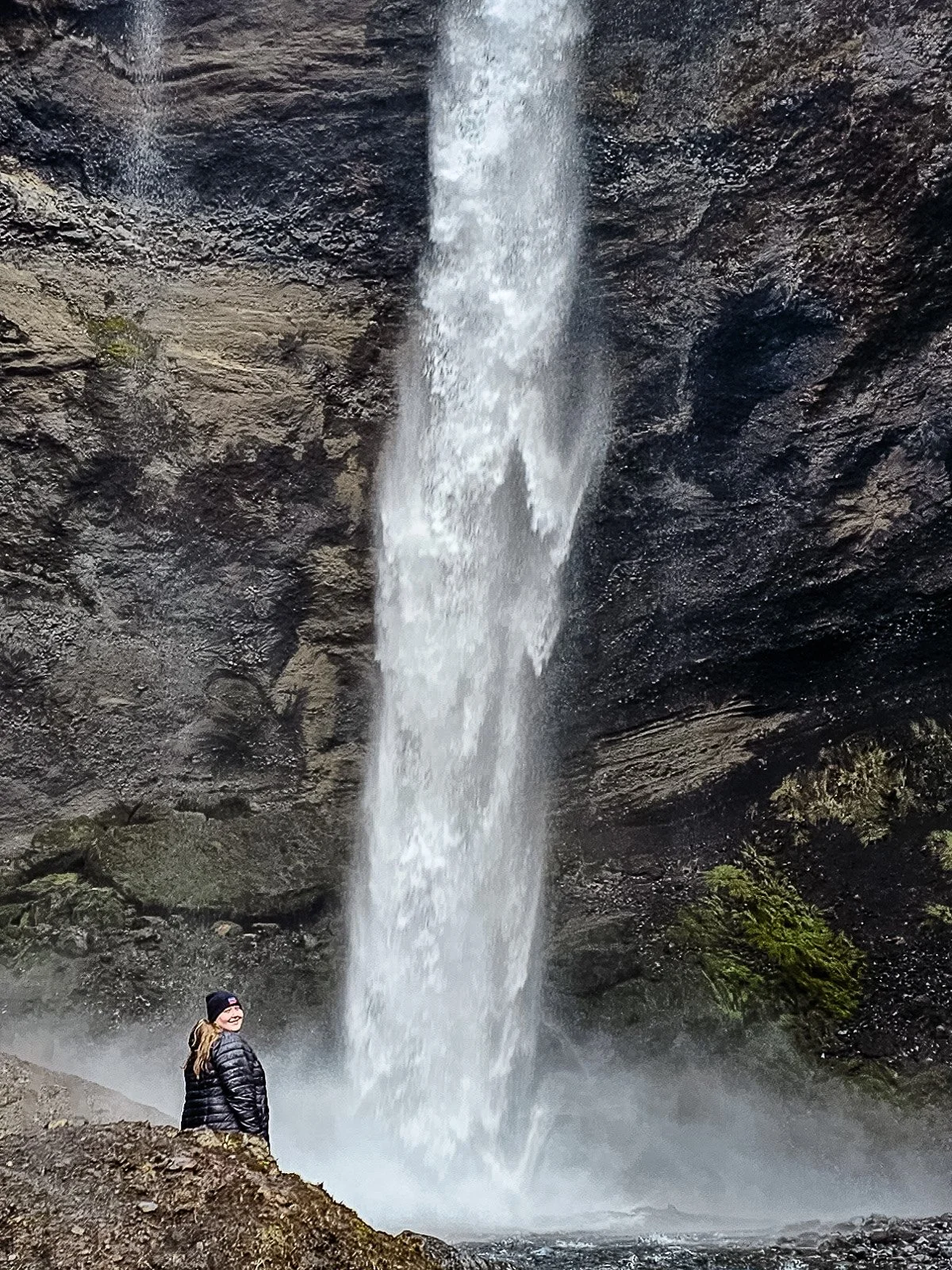
Kvernufoss is only a short distance from Skógafoss, but it receives considerably less attention. A walking trail from the Skógar Museum area leads into a narrow green gorge and eventually to the waterfall. The walk takes roughly 15 minutes each way, depending on your pace, and the waterfall feels much more tucked away than Skógafoss. Under safe conditions, the trail can also take you behind the falling water.
Kvernufoss is one of the easier waterfalls to reach along the South Coast, with the trail beginning near the Skógar Museum parking area.
Would I choose Kvernufoss instead of Skógafoss? No. Would I visit both if I had the time? Absolutely.
Skógafoss gives you the huge, iconic Icelandic waterfall experience. Kvernufoss gives you a quieter walk through a gorge to something that feels a little more hidden.
Sólheimajökull Glacier
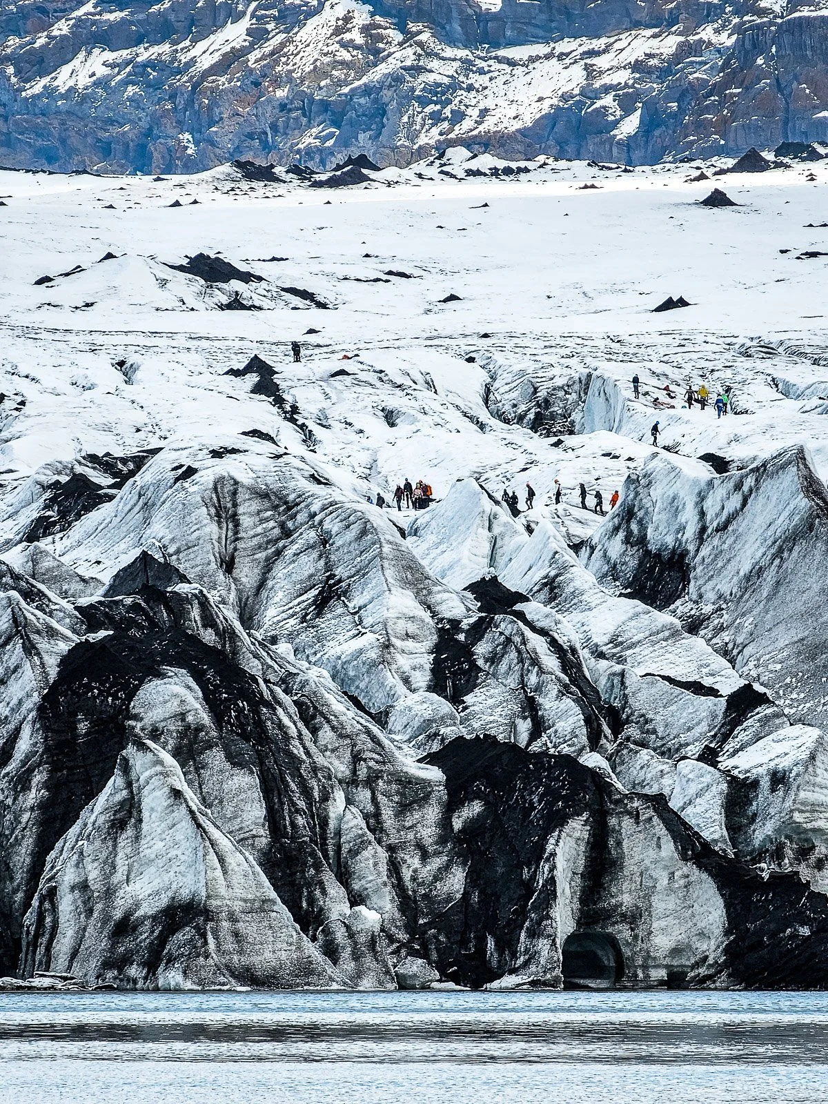
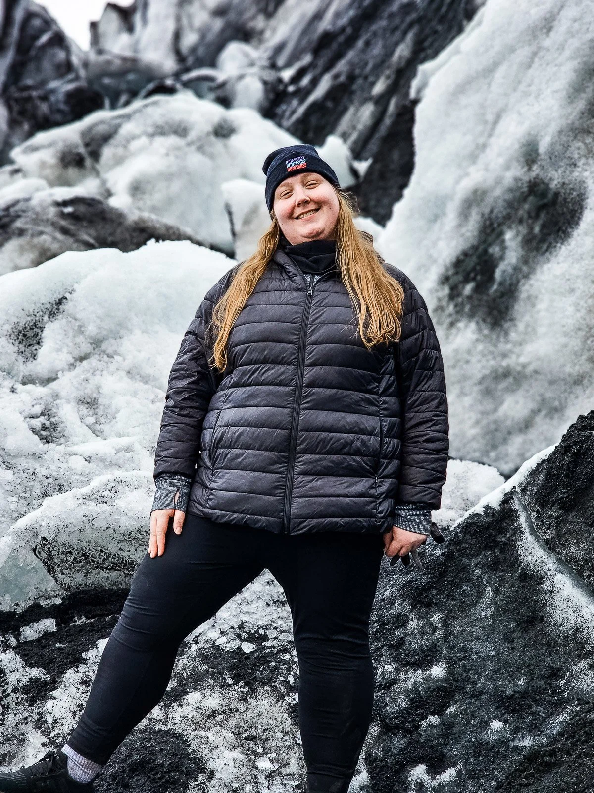
One of the things I love about Iceland is how quickly the landscape changes. You can go from standing underneath a waterfall to looking across a glacier without driving particularly far.
Sólheimajökull is an outlet glacier extending from Mýrdalsjökull and is one of the easiest places along this part of the South Coast to get a close look at a glacier. From the parking area, a walking trail leads toward viewpoints near the glacier and its lagoon.
The glacier has changed significantly over the years, and the distance between the parking area and the ice has increased as the glacier has retreated. You can walk toward the glacier independently, but do not walk onto the glacier itself without a qualified guide and proper glacier equipment. Glaciers are constantly changing environments with crevasses, unstable ice, water, and other hazards that are not always visible. SafeTravel recommends using qualified glacier guides rather than attempting glacier travel independently.
If you want to actually hike on the ice, book a guided glacier hike. Otherwise, the viewpoints still give you an opportunity to see the glacier without committing several hours to an organized activity.
Because glacier conditions can change rapidly, check current access information before visiting.
Sólheimasandur Plane Wreck
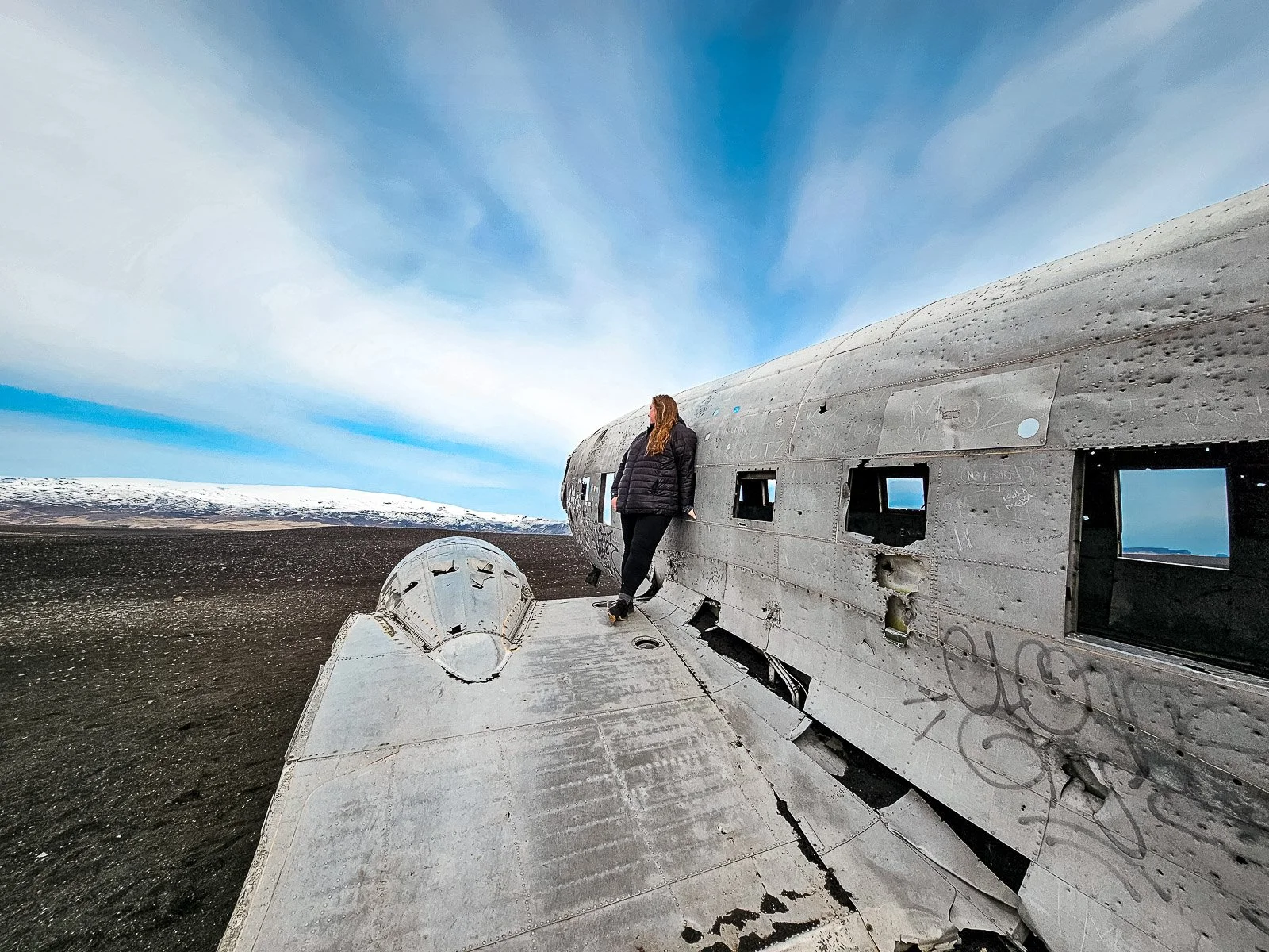
The Sólheimasandur plane wreck looks like something from a movie. In 1973, a U.S. Navy aircraft made an emergency landing on the black sand at Sólheimasandur. Everyone survived, and the aircraft's remains still sit on the enormous black sand plain today.
What photographs do not make obvious is how far it is from the road. You cannot drive your rental car to the wreck. From the designated parking area along Route 1, the walk takes a little under an hour each way.
That means this is not really a quick stop. If you are trying to fit the South Coast into a single day, I would probably skip it unless the plane wreck is one of the things you are most excited to see. You could use those two or more hours at waterfalls, along the coast, or exploring Vík. If you really want to see it, give yourself enough daylight and check current weather conditions before setting out. The landscape is wide open and exposed, and the weather can change quickly.
Paid transportation options are also sometimes available, so check the current shuttle or tour options if you want to see the wreck without spending nearly two hours walking across the sand.
Dyrhólaey
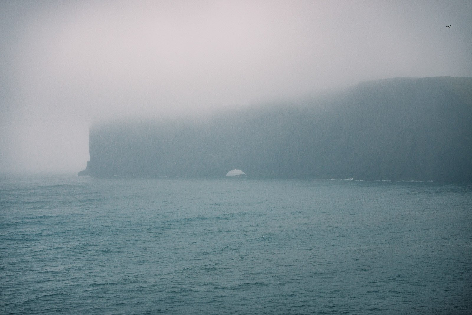
Before reaching Vík, make the detour toward Dyrhólaey. Dyrhólaey is a roughly 120-meter-high promontory overlooking the South Coast. From the viewpoints, you can look across long stretches of black sand beach, see the massive natural arch carved into the headland, and look east toward Reynisfjara and the Reynisdrangar sea stacks. The lighthouse sitting above the cliffs makes the area even more photogenic.
This is also an important bird nesting area and one of the places where you may see puffins during the warmer months. Dyrhólaey is a protected nature reserve, so parts of the area can be temporarily restricted to protect nesting birds. Always follow current signs and closures rather than relying on an old blog post telling you exactly which roads or viewpoints will be open.
Also, pay attention to the wind. This is an exposed cliff area, and the wind can be extremely strong. Stay well back from cliff edges even when the weather seems calm.
Reynisfjara Black Sand Beach
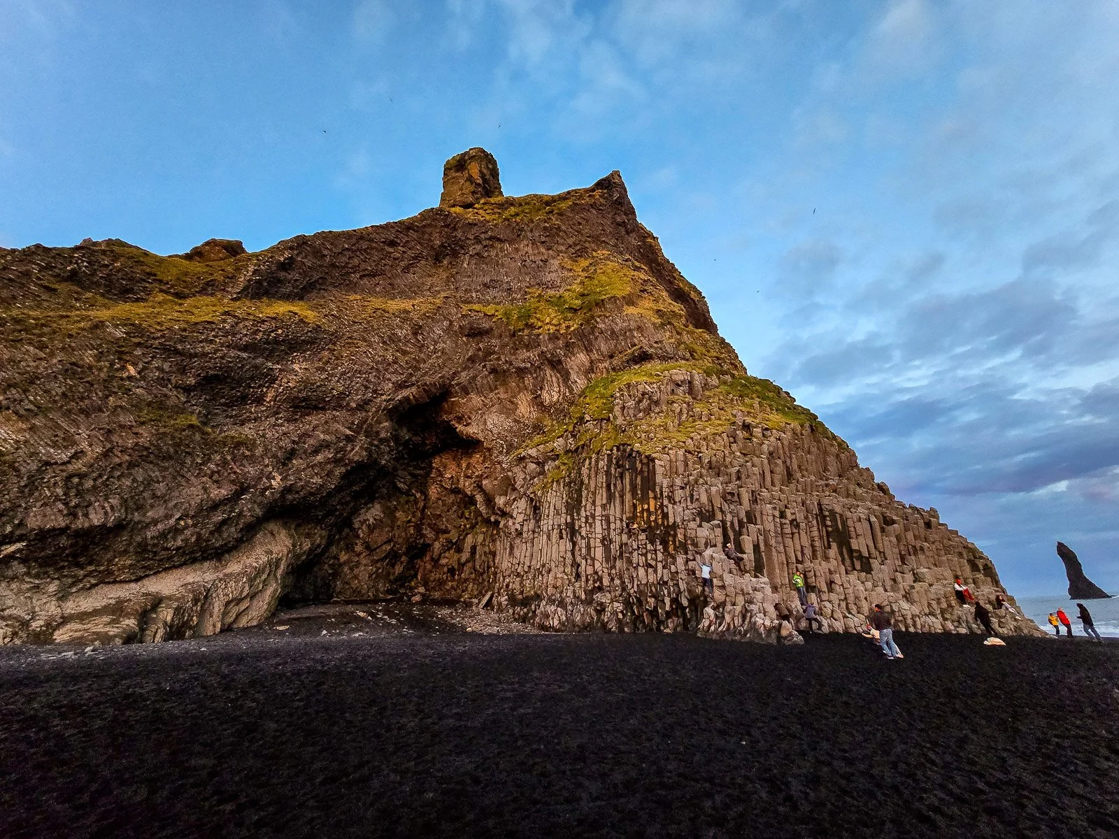
Reynisfjara is one of the most famous places on Iceland's South Coast, and it is absolutely worth visiting. It is also one of the stops where you need to pay the most attention.
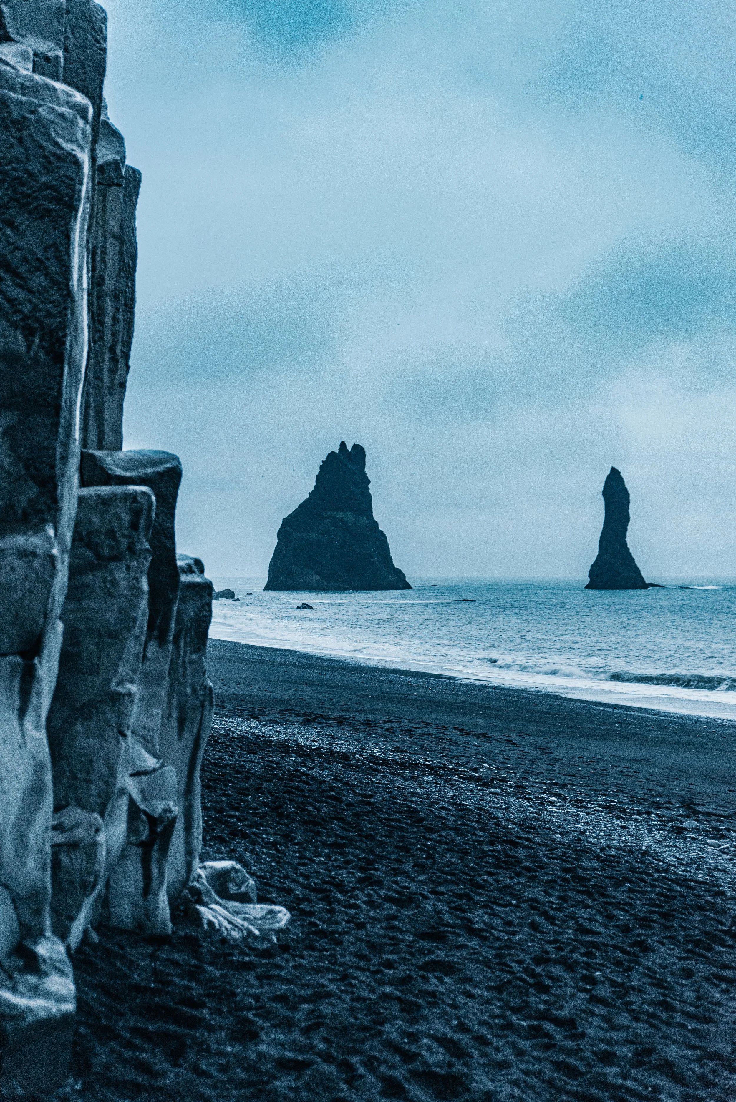
The black volcanic sand, enormous basalt columns, Hálsanefshellir cave, and Reynisdrangar sea stacks make the beach incredibly dramatic. The basalt columns are especially impressive in person. Photographs do not really communicate their scale.
But the ocean here is dangerous.
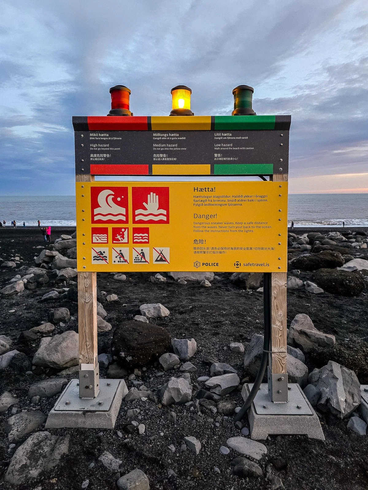
Reynisfjara is known for sneaker waves that can travel much farther up the beach than the waves before them. People have lost their lives here, including in seemingly calm conditions. Never turn your back on the ocean just because you are taking a photograph, and do not walk down to the water's edge because everyone else appears to be doing it.
There is now a warning-light system at the entrance to the beach. Yellow indicates moderate danger, orange indicates considerable danger and requires visitors to remain at least 25 meters from the sea, and red means the beach itself is closed, and visitors must remain in the designated viewing area. Conditions can change quickly, so check the warning signs when you arrive.
Check the current Reynisfjara safety status before you visit, since conditions and access can change quickly.
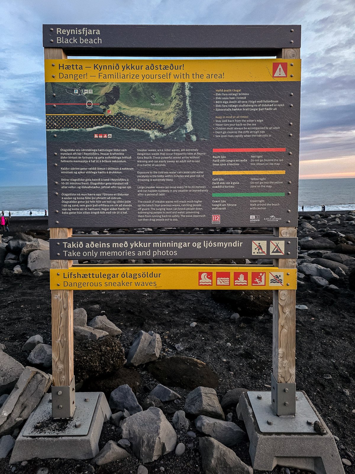
You also need to be aware of falling rocks around the cliffs and cave. I know that all sounds dramatic, but Reynisfjara is perfectly capable of being an incredible stop as long as you respect the environment instead of treating the ocean like a background prop for a photograph.
What I'd recommend: Give yourself at least 30 to 45 minutes, stay well away from the water, and spend some time looking at the basalt formations and Reynisdrangar rather than rushing in for one photo and leaving.
Vík
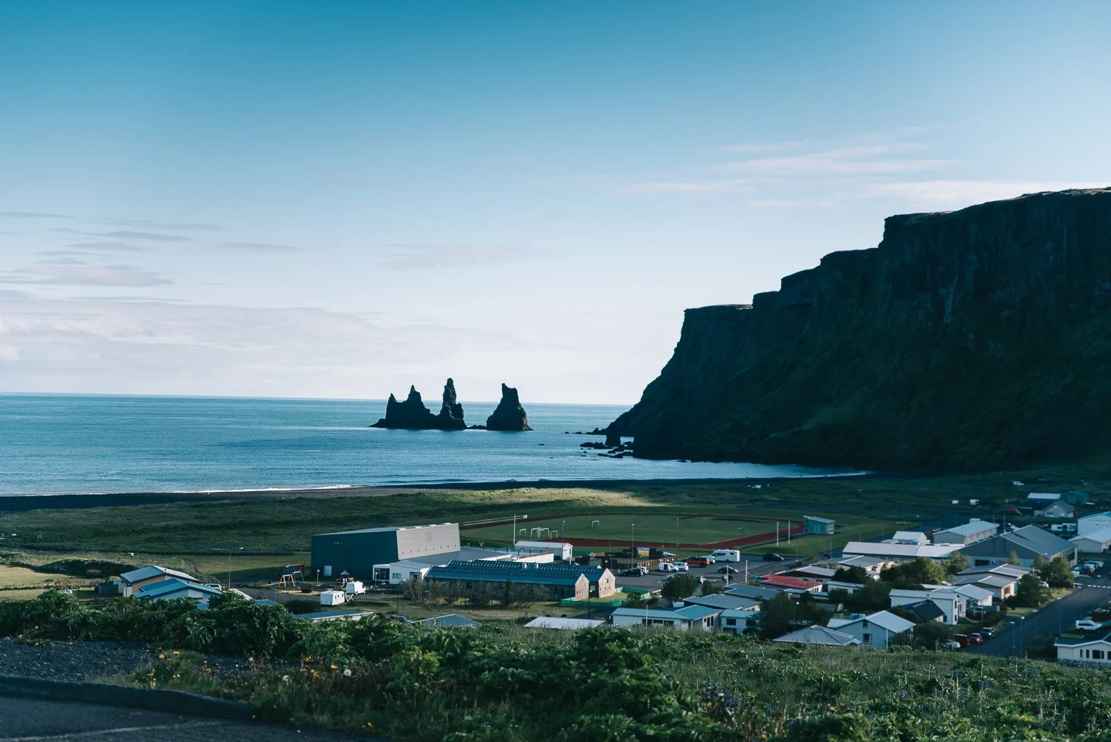
Vík is the small town that becomes an important landmark on almost every South Coast road trip. It is Iceland's southernmost village, situated between the black-sand coastline and the mountains beneath Mýrdalsjökull.
For travelers, Vík is useful because it offers accommodations, restaurants, groceries, fuel, and other services that become increasingly scarce as you continue east. If you're spending two days on the South Coast, this is where I would usually plan to stay overnight.
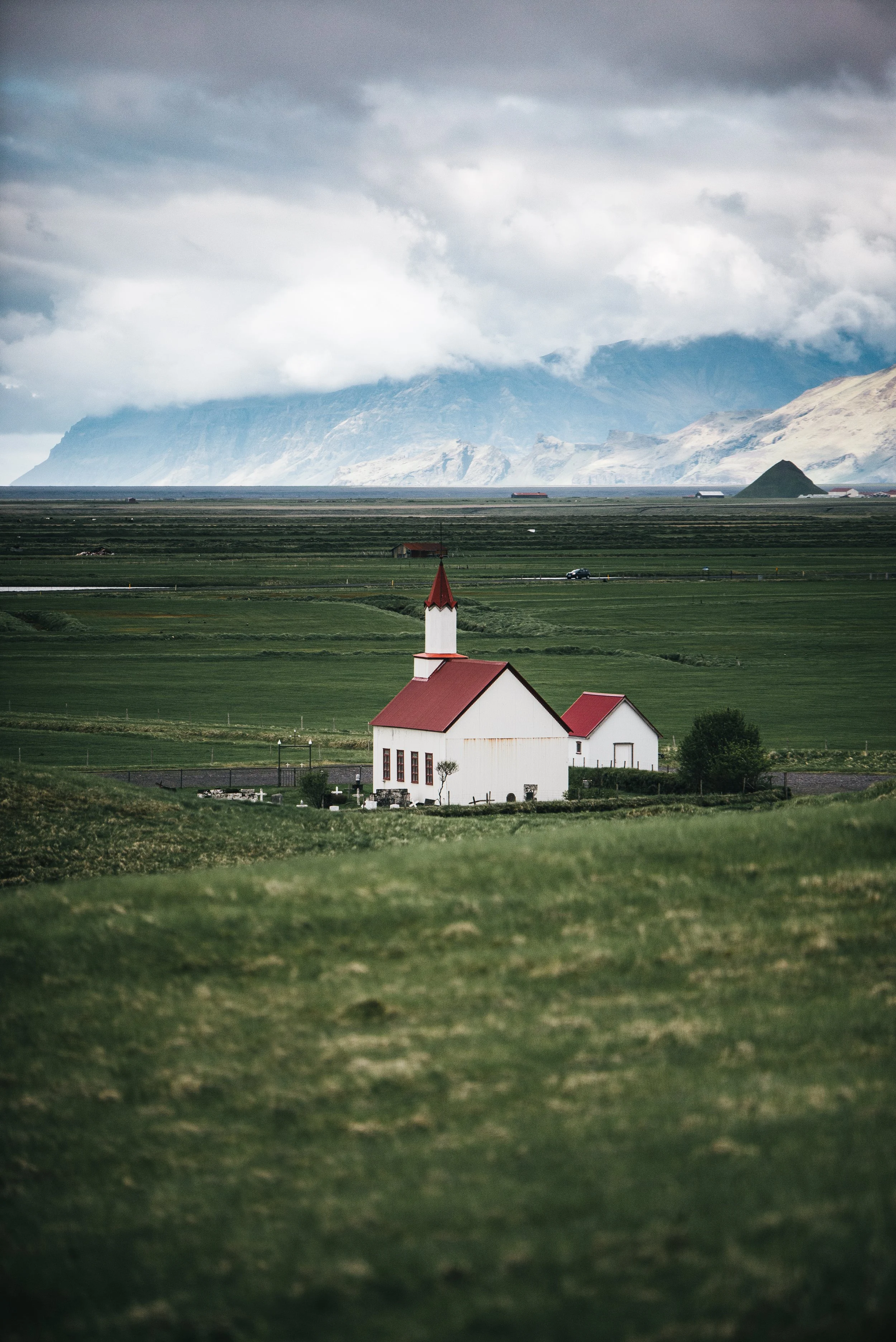
Even if you're not staying, I would stop. One of the most recognizable views is Víkurkirkja, the white church with the red roof overlooking the town. From around the church, you can look across Vík toward the ocean and Reynisdrangar in the distance.
The black sand beach in Vík is another option if you want to see the coastline without returning to Reynisfjara, though the ocean should always be treated with caution.
This is also a good point in the trip to grab food, fill up the car, and decide whether your schedule realistically allows you to keep driving east. That last part is important.
If you want to work some downtime into your South Coast road trip, I also have a complete guide to Iceland's hot springs and geothermal pools, including options that fit naturally along this route.
Eldhraun Lava Field
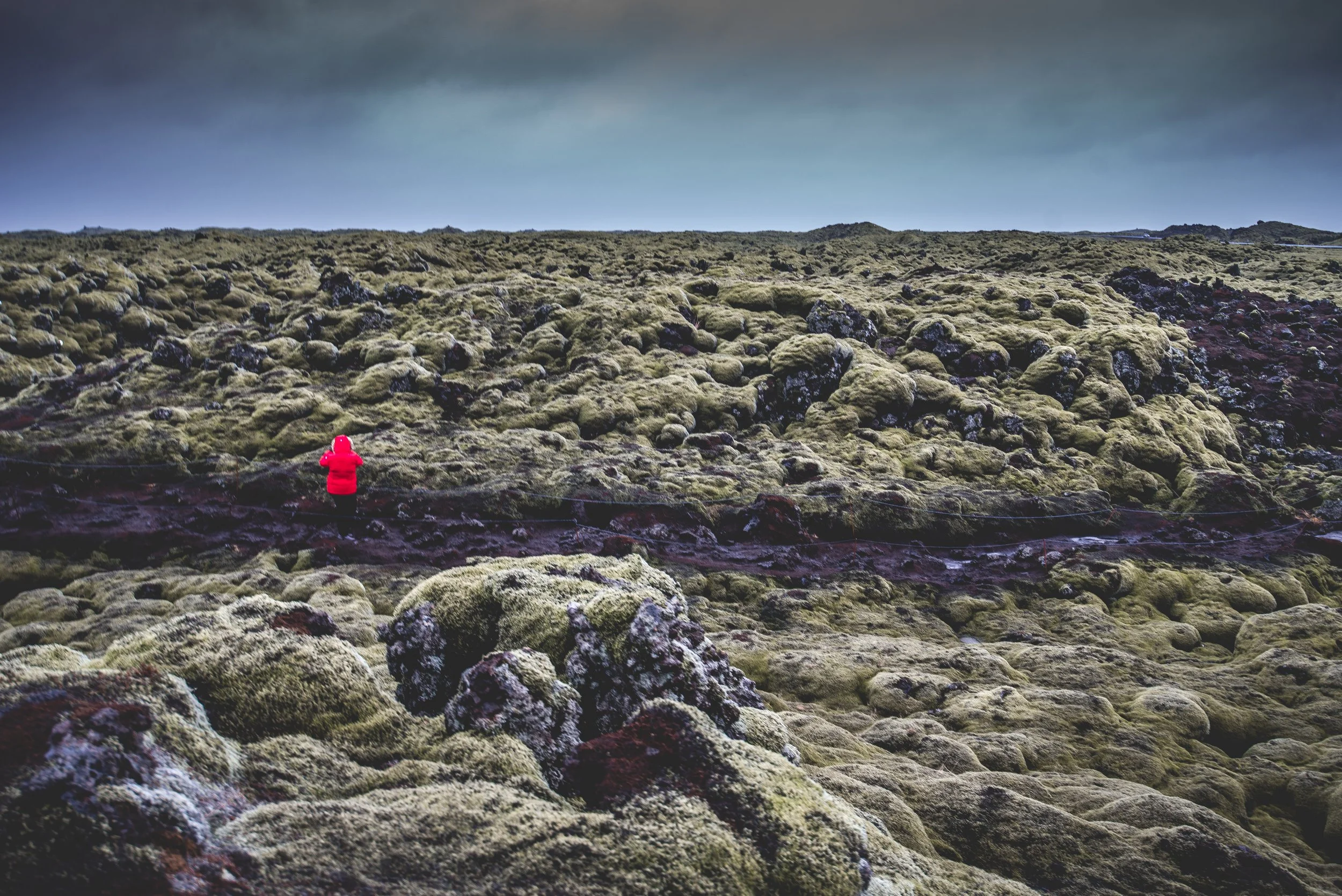
East of Vík, the landscape changes again.
You eventually begin driving through enormous areas of old lava covered in thick green moss. This is part of the lava field created by the devastating Laki eruption of 1783 and 1784, one of the largest lava flows in recorded history. Official South Iceland information estimates that the lava covered roughly 580 square kilometers.
It is beautiful in a strange, almost unreal way. There are designated places where you can stop and look across the lava field. Use those instead of pulling over somewhere unsafe.
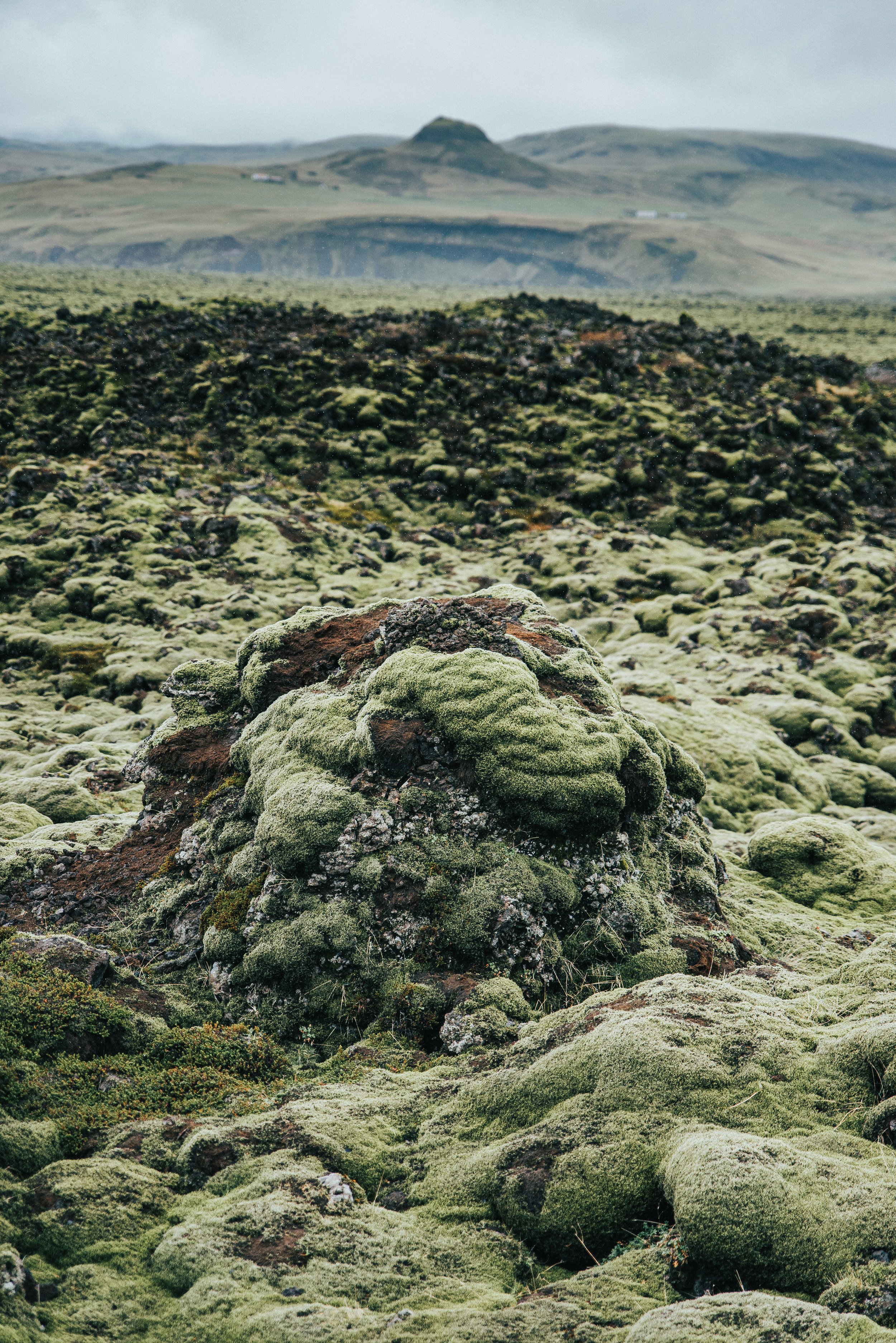
Most importantly, do not walk on the moss. Icelandic moss grows incredibly slowly and can be badly damaged when people walk across it. Something that looks like a soft green carpet from a distance is not there for Instagram photos.
Stay on marked paths and viewing areas.
Fjaðrárgljúfur Canyon
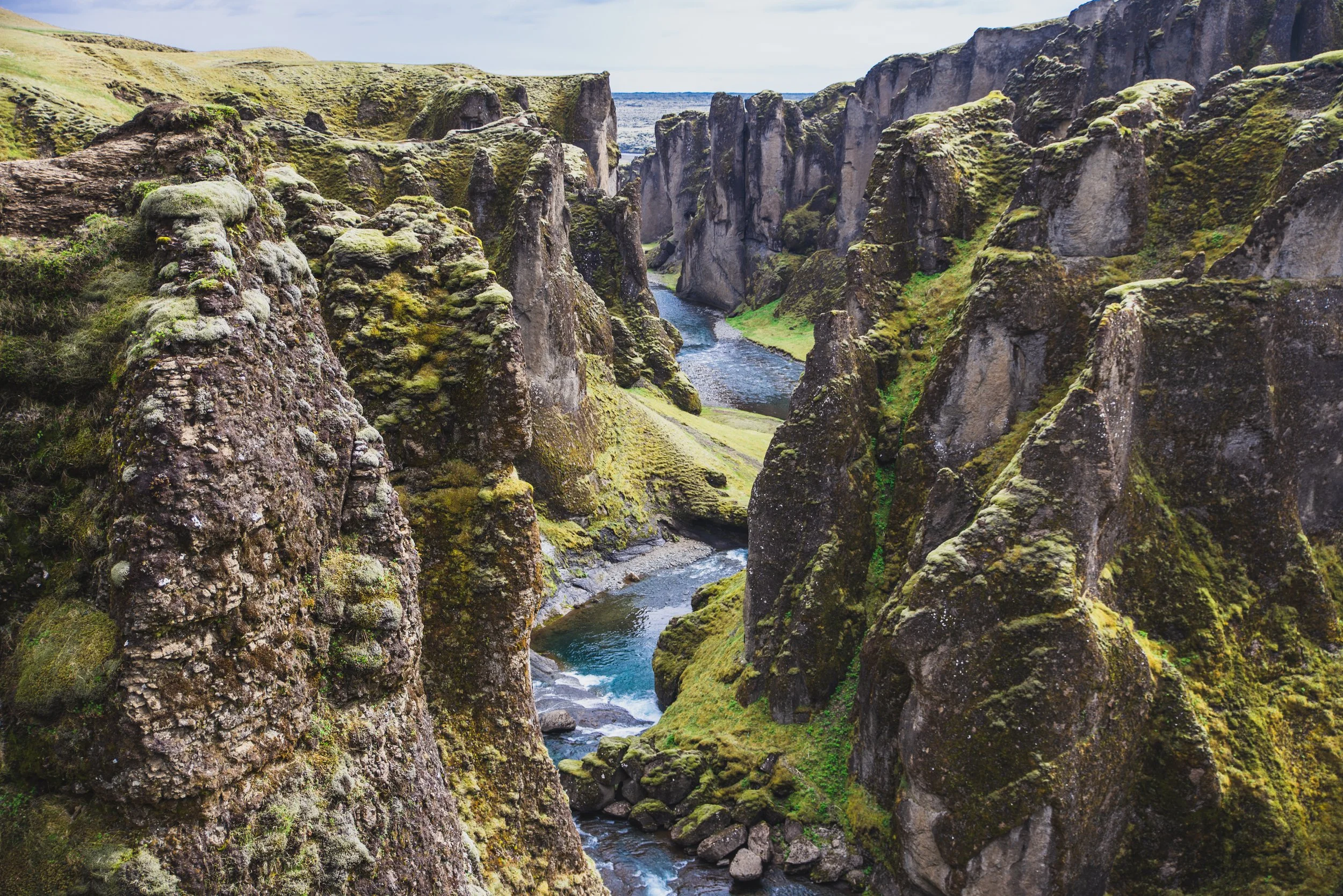
Fjaðrárgljúfur is where I would end the main portion of this guide for travelers doing a shorter South Coast trip. The canyon is approximately 100 meters deep and about two kilometers long, with the Fjaðrá River winding through the bottom. It was formed by erosion associated with glacial activity and is one of those places where Iceland's landscape looks almost too dramatic to be real.
A maintained walking trail follows the upper edge of the canyon toward viewing areas overlooking the river and cliffs. You do not need to hike the entire area to appreciate it. Even the earlier viewpoints are beautiful, but if you have enough time, continue along the designated trail for the broader views farther into the canyon.
Fjaðrárgljúfur has dealt with damage from heavy tourism in the past, which is why staying on the marked trail is especially important here. If an area is closed, do not step around a rope or barrier because the photograph looks better from the other side.
The current official information says the canyon is about six kilometers from Route 1 and can normally be reached by smaller cars, although you should always check road and weather conditions before visiting.
If you have made it this far from Reykjavík, I would strongly consider staying somewhere along the South Coast rather than turning around and trying to race all the way back late at night. Again, ask me how I know.
Have More Time? Continue East
If you have three or more days for the South Coast, I would not stop at Fjaðrárgljúfur.
The scenery continues toward Vatnajökull National Park, and this is where you can add some of the most spectacular landscapes in southeast Iceland.
Skaftafell
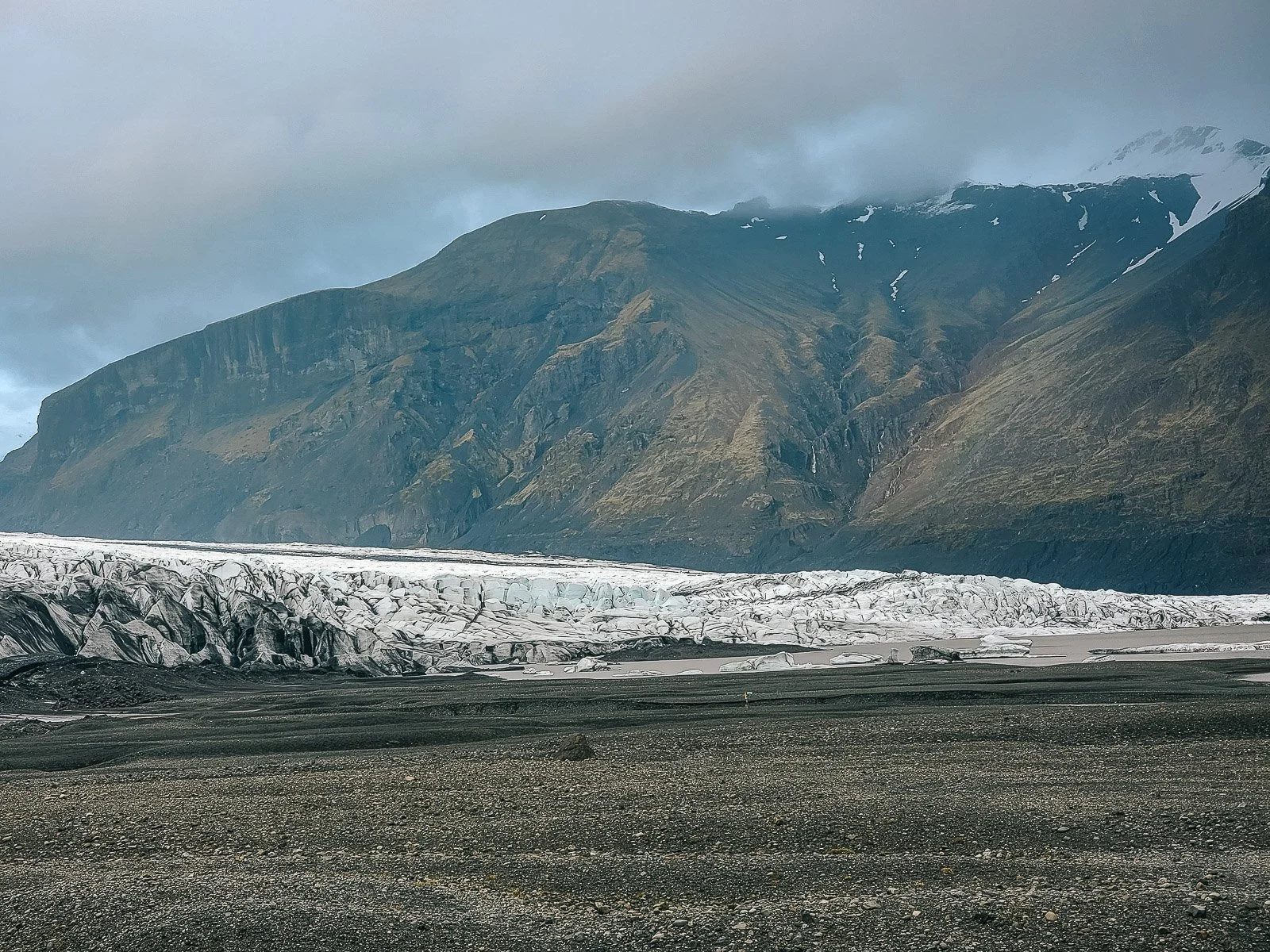
Skaftafell is part of Vatnajökull National Park and is a fantastic area if you want to spend more time hiking rather than simply driving from viewpoint to viewpoint.
There are trails of varying lengths, including routes toward Skaftafellsjökull and Svartifoss. The area can easily take several hours, so I would not casually add it to an already packed sightseeing day. If hiking is one of the main reasons you're visiting Iceland, this is somewhere I would intentionally make room for.
Trail access can change because of weather, maintenance, and seasonal conditions, so check Vatnajökull National Park's current trail information before visiting.
Jökulsárlón Glacier Lagoon
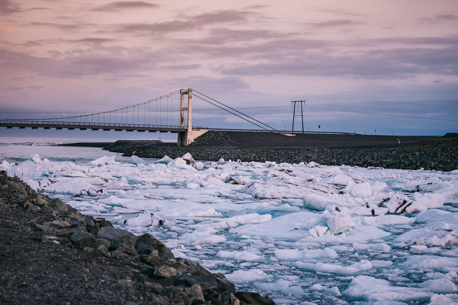
If you have enough time to continue east, Jökulsárlón is one of the stops worth the extra drive. The lagoon sits right beside Route 1 and is filled with icebergs that break away from Breiðamerkurjökull, an outlet glacier of Vatnajökull. The ice slowly moves across the lagoon before eventually reaching the Atlantic Ocean.
Depending on the season and conditions, the amount and size of the ice can look completely different from one visit to another. You may also see seals in the lagoon.
During the appropriate season, boat tours operate on the lagoon if you want to get a closer look at the icebergs.
Even without a tour, though, I would give yourself time simply to walk along the lagoon and photograph it.
Diamond Beach
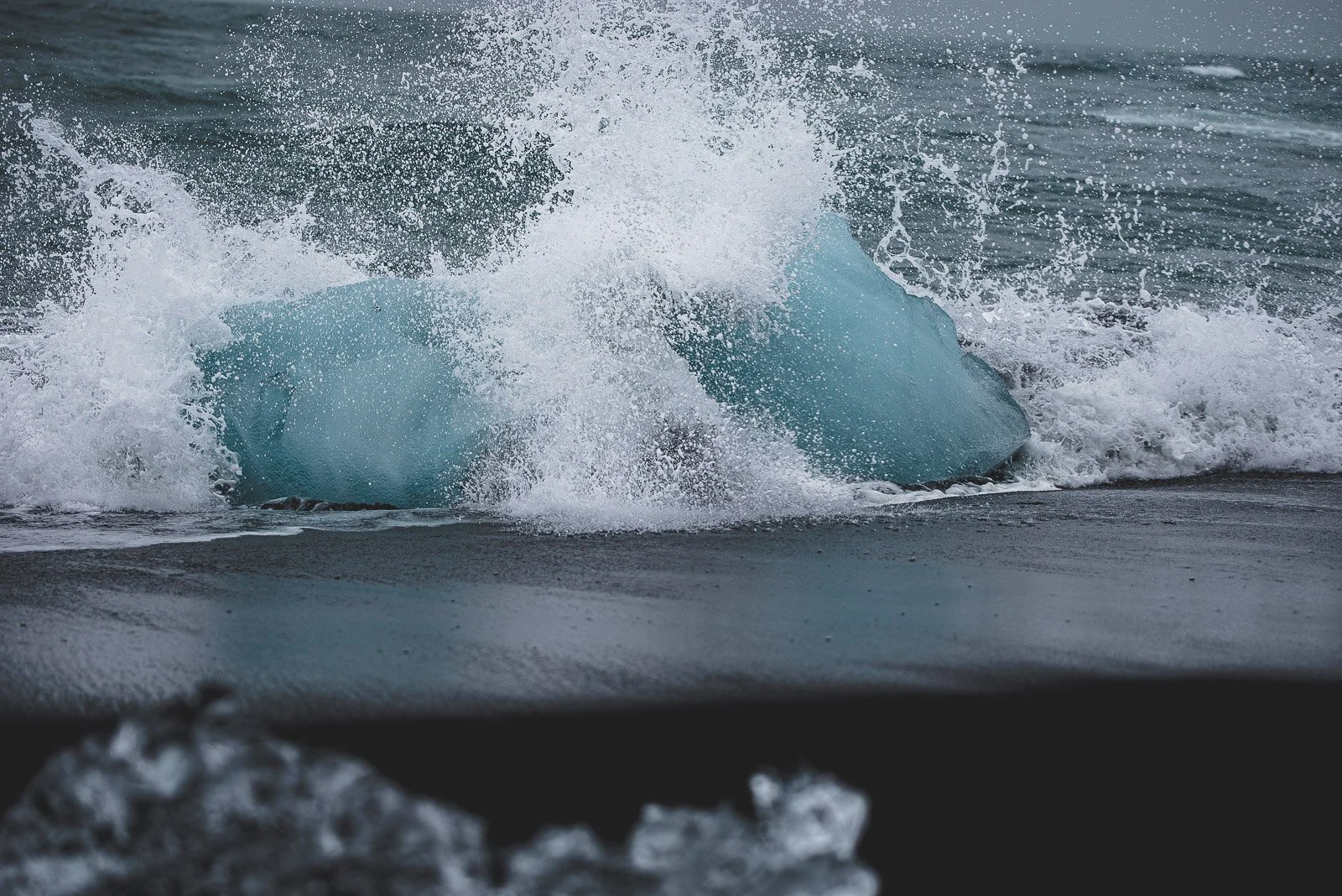
Across Route 1 from Jökulsárlón is Breiðamerkursandur, better known to visitors as Diamond Beach. Ice from the lagoon flows toward the Atlantic, and pieces are sometimes washed back onto the black sand, creating the famous contrast between clear, blue ice and the dark beach. The amount of ice varies with tides and conditions, so there is no guarantee the beach will look exactly like whatever photograph convinced you to visit.
Do not climb onto the ice, especially pieces near the ocean. Waves here can also travel unexpectedly far onto the beach. Jökulsárlón and Diamond Beach are right next to each other, so I would always visit both.
How I Would Organize a South Coast Road Trip
If I had one day from Reykjavík, I would leave early and prioritize Seljalandsfoss and Gljúfrabúi, Skógafoss, Dyrhólaey, Reynisfjara, and Vík. Kvernufoss or Sólheimajökull could be added if daylight and timing allow, but I would rather enjoy the major stops than turn the day into a race.
With two days, I would spend the first day moving toward Vík and stay overnight there. That gives you more time for Kvernufoss and Sólheimajökull and makes it much easier to continue toward Eldhraun and Fjaðrárgljúfur the next morning.
With three days or more, I would continue east into Vatnajökull National Park and include Skaftafell, Jökulsárlón, and Diamond Beach.
If you're trying to combine the South Coast with the Golden Circle during a short trip, my 3-day Iceland itinerary shows how I would realistically fit both regions into one trip without making the schedule feel impossible.
A Few Things I Have Learned About Driving Iceland's South Coast
Iceland constantly tempts you into adding "just one more stop." That is part of what makes driving here so much fun, but it is also why I would avoid creating an itinerary where every hour is accounted for. Leave extra time. Keep your gas tank reasonably full. Services become farther apart as you travel east, and there is really no benefit to waiting until the warning light comes on.
Carry food and water in the car. I usually stop at a grocery store before beginning an Iceland road trip because it saves money and prevents me from having to organize sightseeing around restaurant hours.
Bring waterproof clothing even when the weather forecast looks good. Several of the best stops in this guide involve deliberately walking toward very large quantities of falling water.
Protect your camera equipment. Seljalandsfoss, Gljúfrabúi, Skógafoss, and rainy Icelandic weather have absolutely no concern for how much your lens costs.
Pay attention to daylight. This barely matters around midsummer and matters enormously during winter.
Most importantly, check conditions every day. Icelandic weather changes quickly enough that the itinerary you planned at home should always be considered a plan, not a contract.
Final Thoughts
Iceland's South Coast packs an almost unreasonable amount of scenery into one road trip. You can stand behind a waterfall in the morning, walk toward a glacier a few hours later, watch waves crash onto a black sand beach in the afternoon, and end the day surrounded by mountains in Vík.
That variety is exactly why I keep recommending this part of Iceland, especially to anyone visiting for the first time or trying to make the most of a limited amount of PTO.
My biggest advice is not to rush it more than you have to. It is very easy to look at all of these locations on a map and convince yourself that you can fit every single one into one day. Technically, maybe you can. But some of my favorite memories from Iceland came from having enough time to stop somewhere longer than expected or pull over because the landscape was too beautiful to drive past.
Pick the places that matter most to you, leave room for the unexpected, and keep an eye on the weather.
And whatever you do, bring a waterproof jacket.
Happy travels!



How much does a trip to Iceland really cost? This realistic Iceland budget guide breaks down flights, hotels, rental cars, food, gas, road fees, activities, and the actual cost of one of my 4-day Iceland trips.